


Current and Future Projects in the Area
Littleton has three important projects in various stages of design around the Santa Fe Drive and Mineral Avenue intersection, while Douglas County is currently under construction on a project to improve Santa Fe Drive immediately to the south.
Click or tap on the circles below for a brief overview of each project.
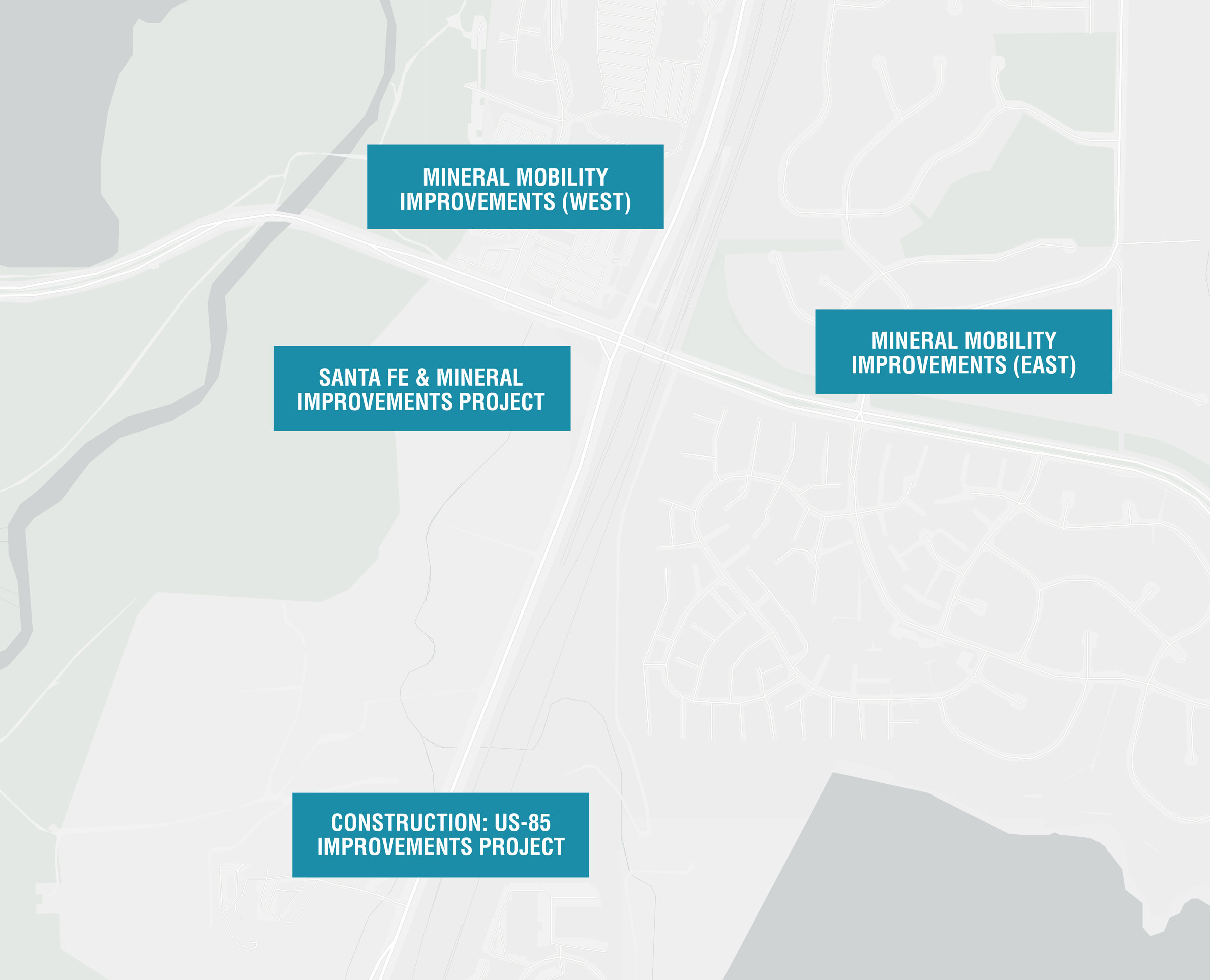
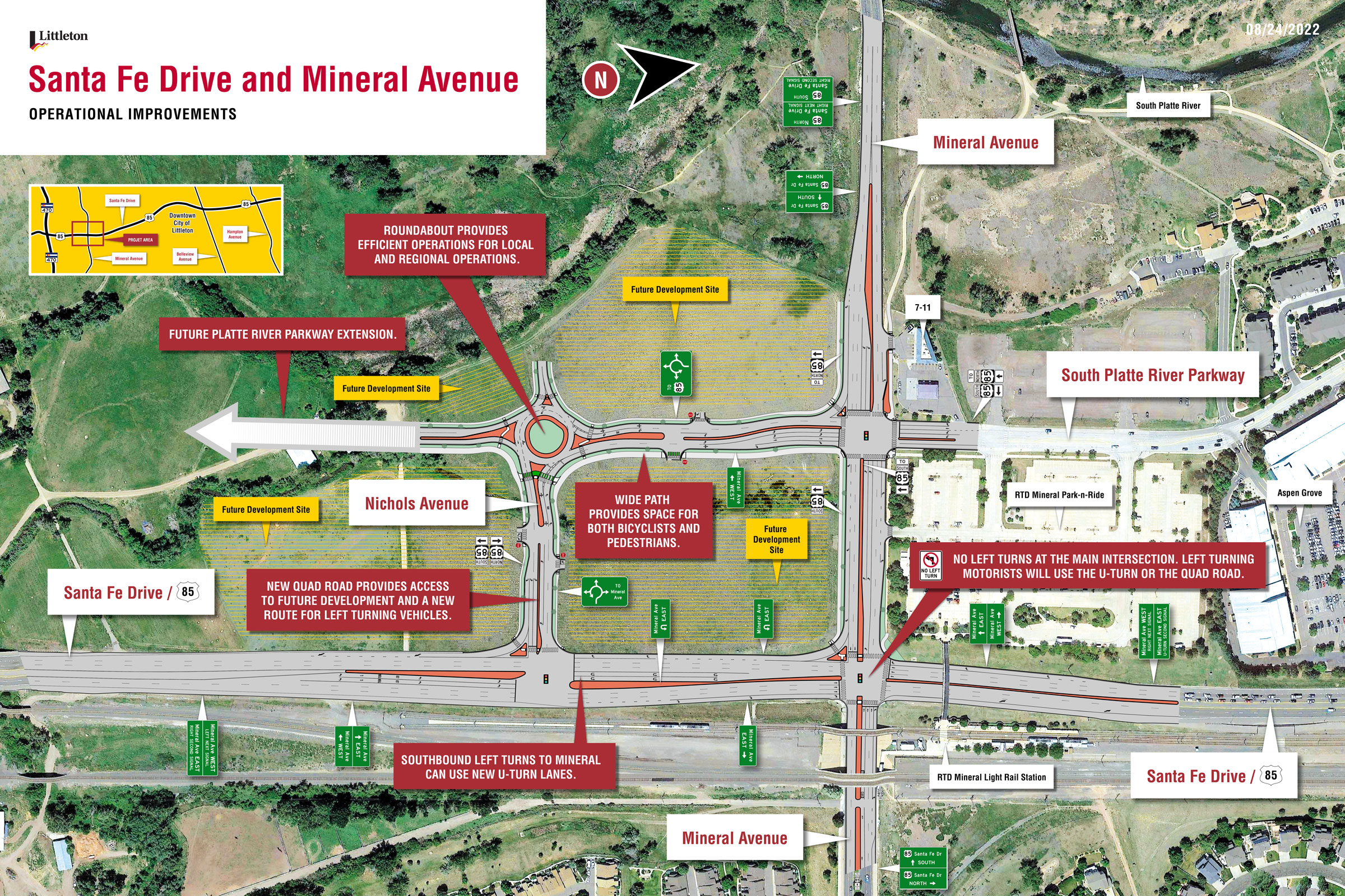
Santa Fe & Mineral Improvements Project
Those who have experienced the Santa Fe Drive and Mineral Avenue intersection know that it is one of the most congested intersections in the City of Littleton. This intersection accommodates nearly 60,000 vehicles per day along Santa Fe Drive and 30,000 vehicles per day along Mineral Avenue
A New Quadrant Roadway
A new quadrant roadway will be constructed in the southwest parcel of the intersection. The quadrant roadway concept will remove left turning movements from the Santa Fe Drive and Mineral Avenue intersection, redirecting vehicles onto the quadrant roadway to complete the left turn movements. This diversion allows for additional green time to be provided to the through and right turn movements, both north-south along Santa Fe Drive and east-west along Mineral Avenue. This project will provide a new traffic signal along Santa Fe Drive for access to/from the quadrant roadway and revised traffic signals along Mineral Avenue at Santa Fe Drive and Platte River Parkway, along with new lane configurations, traffic signal retiming, and mobility improvements throughout the project extents and to surrounding areas.
What We Heard
Based on previous community engagement over the past year, the City of Littleton understands that many of you have never heard of the quadrant roadway concept and don't believe it will help congestion. If the intersection remains in the current configuration, delays will become significantly worse given traffic volumes are projected to grow to 115,000 vehicles per day by the year 2040 due to anticipated future development in the immediate area, as well as to the south in Douglas County and west in Jefferson County. Change and a new concept can be scary, but the quadrant roadway is a proven solution that will accommodate this increase in traffic, minimize delays, and improve safety.
Driving Through a Quadrant Roadway
Watch these videos to learn more about how a quadrant roadway works.
Northbound Traffic
Southbound Traffic
Eastbound Traffic
Westbound Traffic
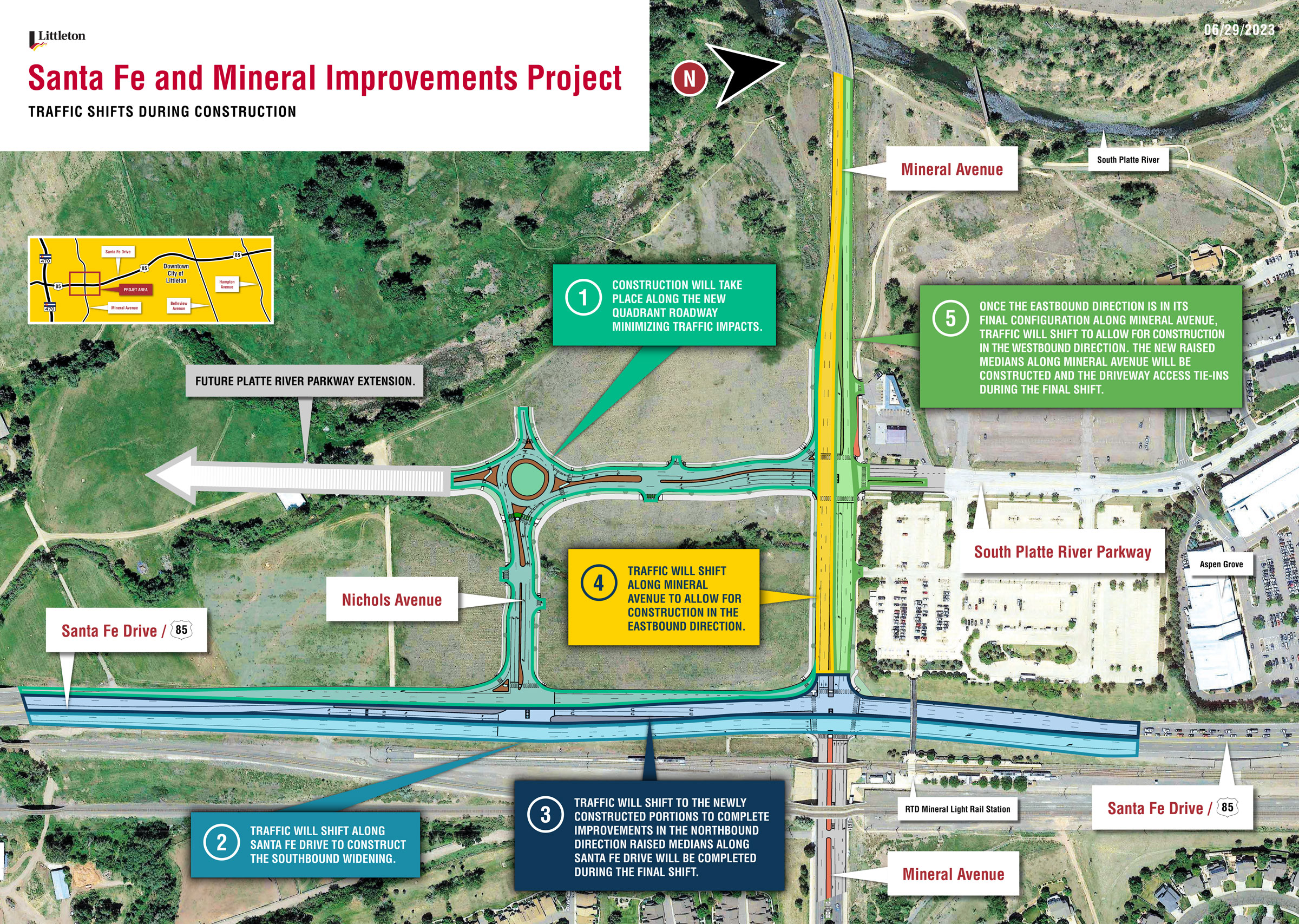
What to Expect During Construction
If you have driven along the Santa Fe Drive corridor recently, you may have noticed the construction activities for the US-85 Improvements project. This project will be underway until the fall of 2025. The City of Littleton will coordinate construction timing with the on-going Douglas County project to help minimize disruptions to the public.
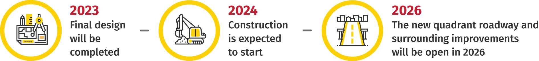
The quadrant roadway will be constructed off the main routes so impacts to traffic will be minimized. Along Santa Fe Drive, there will be two northbound lanes and two southbound lanes open during construction. Mineral Avenue will have one to two lanes open in the eastbound and westbound directions during construction. Construction fo these improvements will begin in 2024 and take up to two years to complete before being fully operational in 2026.
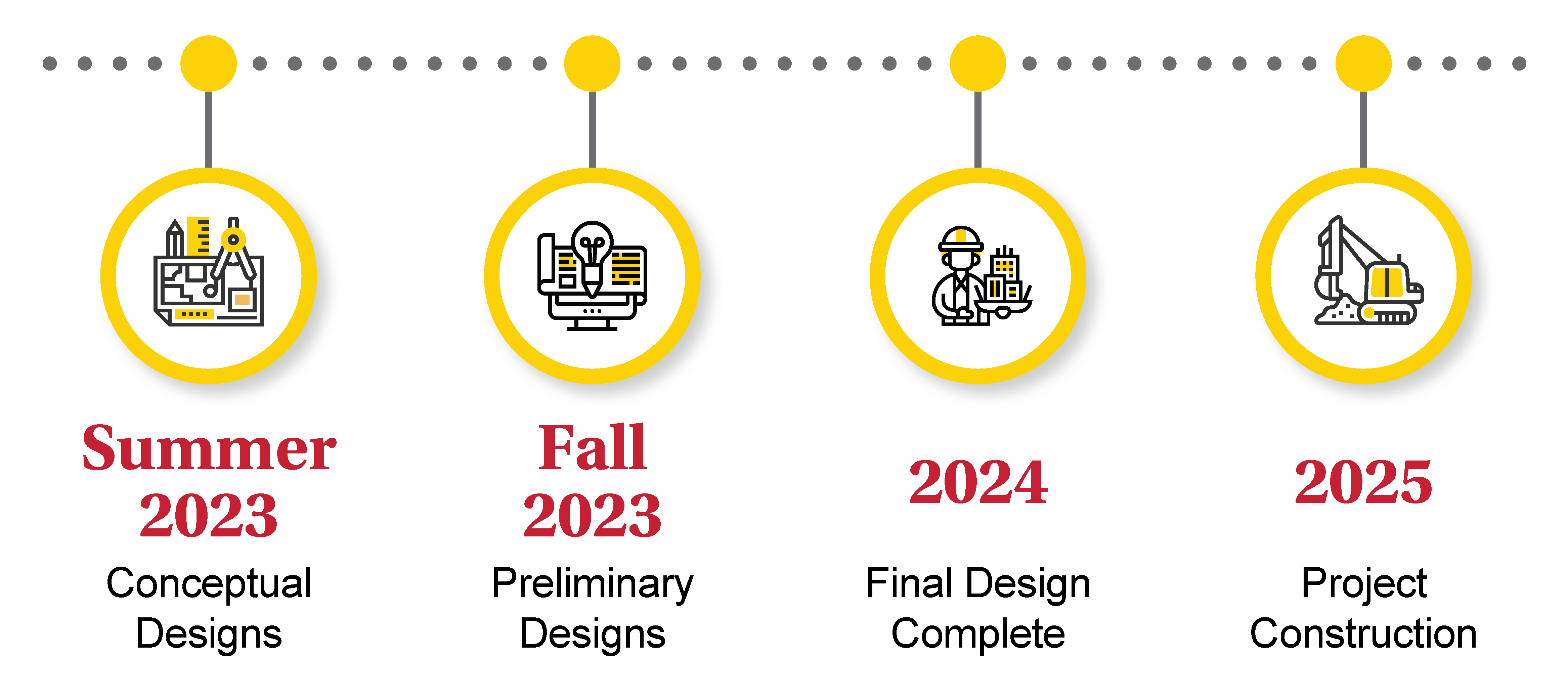
Click image to enlarge.
Timeline
Mineral Mobility Improvements (East)
The Mineral Mobility Improvements (East) project has been split into two phases based on the funding sources and anticipated construction timing. Detailed descriptions of the phase 1 elements have been completed and are listed below and are identified on the image below by the yellow notes. Design of the phase 2 elements, generally described below and represented by the purple notes on the image, are still being finalized. Construction of both phases are anticipated to be completed in 2024.
Phase 1
Enhance the existing bike lanes to be buffered bike lanes on each side of the street (to be converted to protected bike lanes in the future once maintenance of the bike lanes can be resolved)
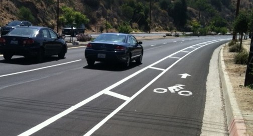
Example of a buffered bike lane, where striping is used to create separation for bicyclists from vehicles in the adjacent lane.
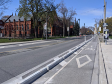
Example of a protected bike lane, where both a horizontal separation is created by striping and a vertical barrier is provided in the form of a curb or other impediment.
Intersection modifications to reduce vehicle speeds, to provide protection for bicyclists from turning vehicles, and to clearly direct pedestrians and shorten crossing distances.
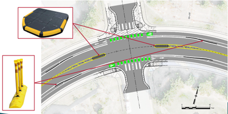
Proposed layout for intersection
Crossing modifications to reduce vehicle speeds through the curve, along with a pedestrian activated Rectangular Rapid Flashing Beacon, where lights flash both at the crossing and in advance of the crossing for northbound traffic to alert drivers of the presence of a pedestrian or bicyclist.
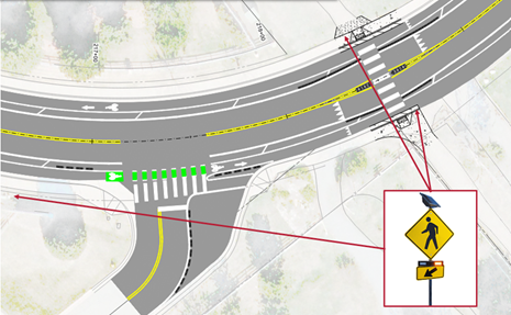
Proposed layout for area around crossing
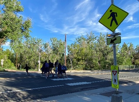
Example of a pedestrian activated rectangular rapid flashing beacon
Paved trail with designated space to separate bicyclists and pedestrians
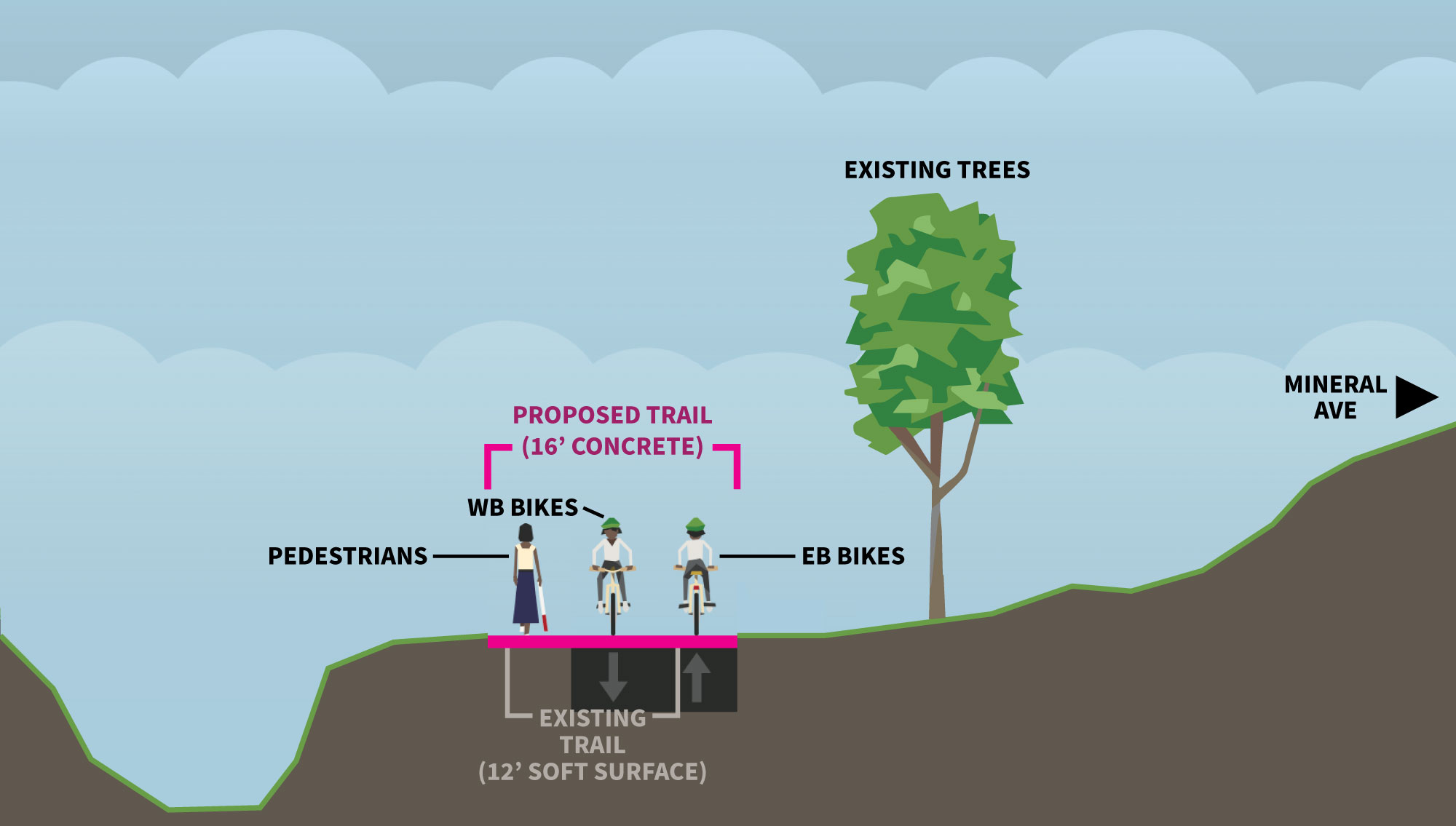
Trail Cross Section; Click image to expand
Enhance the existing bike lanes to be buffered on each side of the street (to be converted to protected bike lanes in the future once maintenance of the bike lanes can be resolved) from Jackass Hill Road to Windermere Street, and encourage bicyclists out of the roadway onto the shared use path west of Jackass Hill Road.
Example of a buffered bike lane, where striping is used to create separation for bicyclists from vehicles in the adjacent lane.
Example of a protected bike lane, where both a horizontal separation is created by striping and a vertical barrier is provided in the form of a curb or other impediment.
Improved bicycle and pedestrian crossing with better visibility for vehicles on Mineral Avenue, more clearly defined crossing for trail users, and upgraded facility equipment. (The city continues to pursue funding opportunities for an underpass as the ultimate vision.)
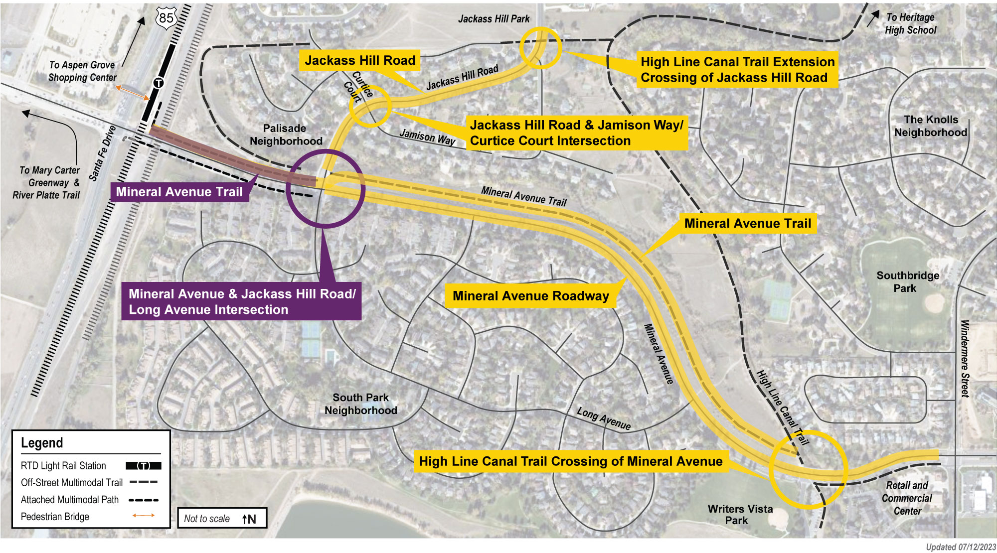
Phase 2
A second phase (shown in purple on the map) will provide improvements to the Mineral Avenue & Jackass Hill Road/Long Avenue intersection to add physical and signal timing separation for bicyclists and pedestrians, as well as widening the sidewalk on the north side of Mineral Avenue between Jackass Hill Road and the bridge to RTD’s Mineral Light Rail Station.
The emergency repair of the culvert at Jackass Hill Road just north of Mineral Avenue will integrate into the planned intersection improvements in this second phase of the project.
Mineral Mobility Improvements (West)
Coming Soon
The Mineral Station Area Multimodal Improvements project will be underway by the end of the summer to enhance connectivity and mobility for pedestrians and bicyclists between the RTD light rail station, surrounding neighborhoods, and the Mary Carter Greenway Trail. This project includes new bicycle and enhanced pedestrian sidewalks along Platte River Parkway and Carson Drive to the Mary Carter Greenway Trail. This project will also connect to the multi-use trail being designed along the new segment of Platte River Parkway south of Mineral Avenue with the Santa Fe & Mineral Improvement project as part of the quadrant roadway and associated with the planned development. This is one of the numerous projects the city is undertaking to improve mobility in this area.
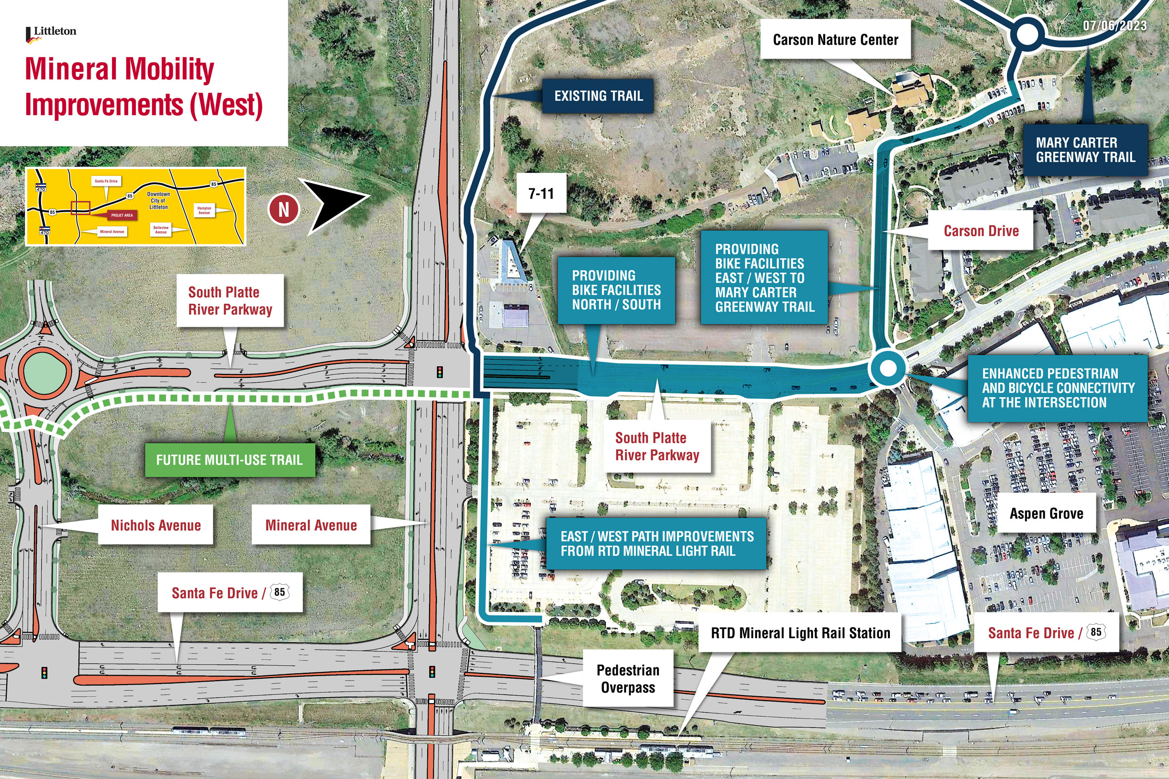
Click image to enlarge.
Timeline
Stay Involved!
Thank you for your involvement in these transportation and mobility improvement projects.
Santa Fe & Mineral Improvements Project
Mineral Mobility Improvements (East)
Mineral Mobility Improvements (West)
Project Website Coming Soon